Source Data
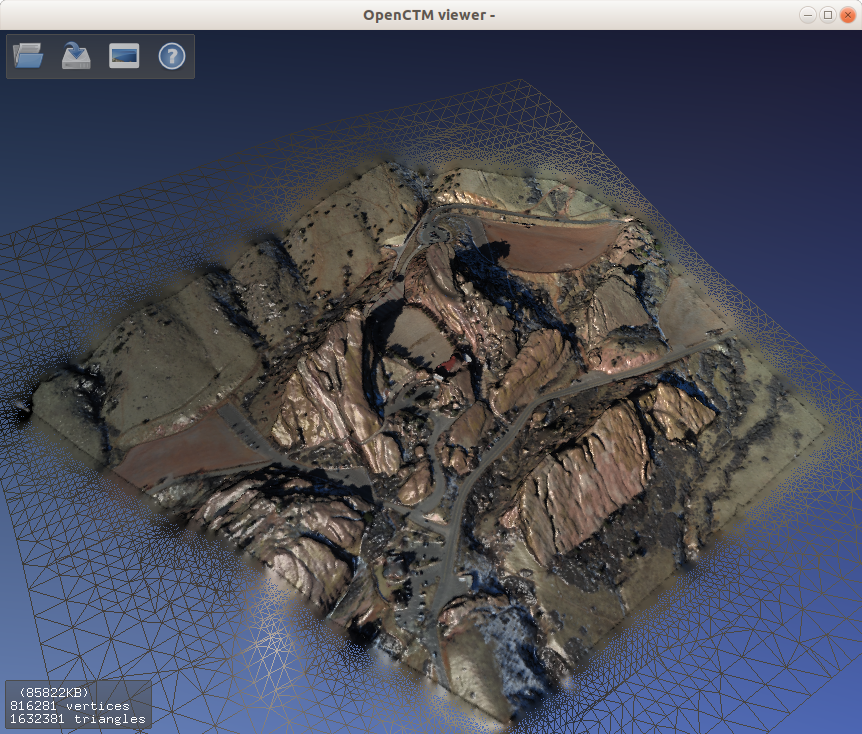
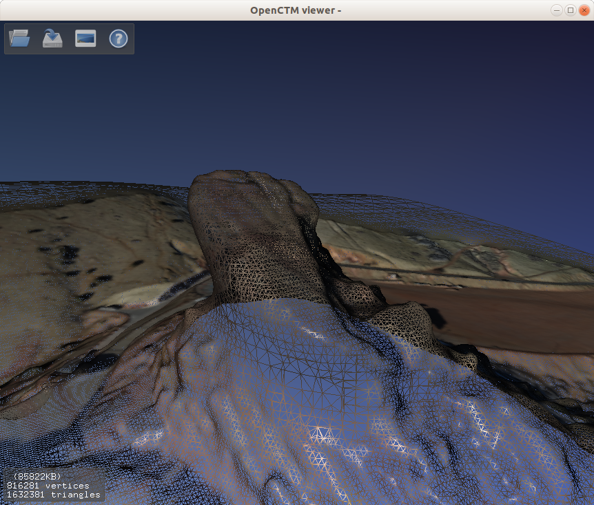
Looking at Red Rocks.

PDAL pipeline
# This is a hjson file, https://hjson.org/
# Linux bash
#GET=https://github.com/hjson/hjson-go/releases/download/v3.0.0/linux_amd64.tar.gz
# macOS bash
#GET=https://github.com/hjson/hjson-go/releases/download/v3.0.0/darwin_amd64.tar.gz
# Install
#curl -sSL $GET | sudo tar -xz -C /usr/local/bin
# Translate to Json
#hjson -j pipeline.hjson > pipeline.json
#pdal pipeline pipeline.json --verbose 8

{
  pipeline:
  [
# Input
    {
      # read from our ept server
      # up to 0.5m resolutions
      # type: readers.ept
      # bounds: ([802000, 802500], [2493000, 2493500])
      # filename: http://localhost:8080/ept.json
      filename: red-rocks.laz
      # filename: http://na.entwine.io/red-rocks/ept.json
      # resolution: 0.5
    }
#     {
#       # read from our las file
#       type: readers.las
#       filename: small500-no-outliers.laz
#     }


# Filters
    {
      # adds a classification value of 7 to the noise points
      type: filters.outlier
      # method: radius
      # radius: 1.0
      # min_k: 8 # min number of neighbors in radius

      method: statistical
      mean_k: 8
      multiplier: 3

    }

    {
      # voxel-based sampling filter
      # reduce the size of the pc
      # cell size of 0.2 meters in xyz
      type: filters.voxelcenternearestneighbor
      cell: 0.1
    }

    {
      # Need to assign point cloud dimension NumberOfReturns 1
      # Otherwise: "No returns to process."
        type:filters.assign
        assignment : NumberOfReturns[0:0]=1
    }

    {
      # Ground classification, ignore the noise points
      type: filters.smrf
      ignore:Classification[7:7]
    }

    {
      # only allow ground classified points
      type: filters.range
      limits: Classification[2:2]
    }

    {
      # OPTIONAL
      # turn this into a DEM 3D model
      # do not use multiple types
      # type: filters.delaunay
      type: filters.poisson
    }


# Output

# # OPTIONAL PLY IF DEM
    {
      # write to ply
      type:writers.ply
      filename: red-rocks-smrf-only-poisson.ply
      faces:true
      storage_mode: default
    }
# Output
    # {
    #   # write to laz
    #   type:writers.las
    #   filename: red-rocks-ground.laz
    # }
  ]
}
https://gist.github.com/sunapi386/9a9ece302d646ee80a72fc494423a633
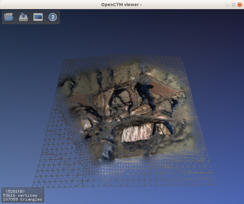
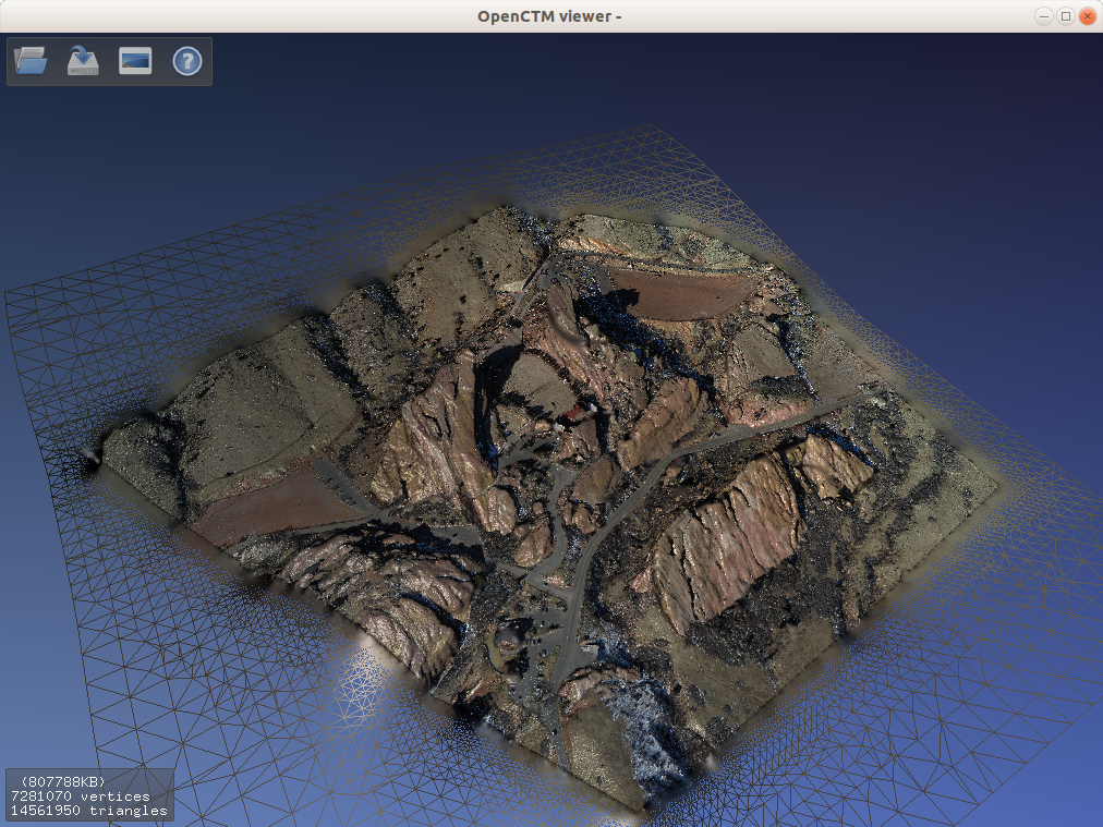
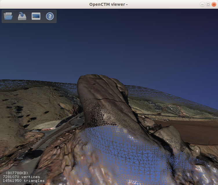
Mesh Results
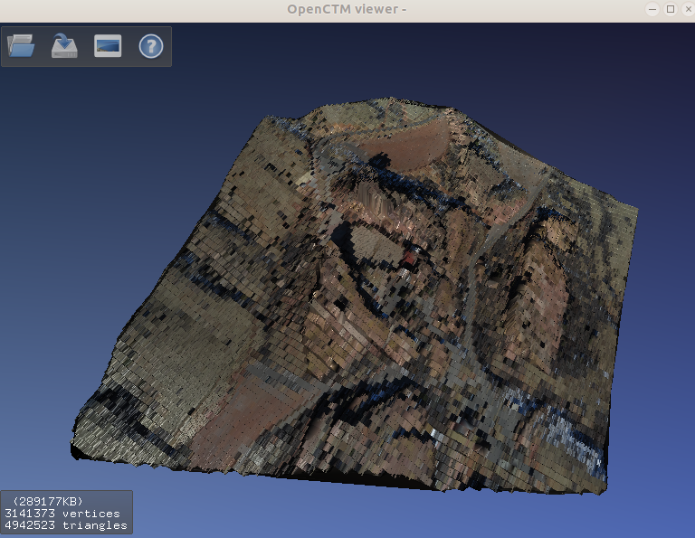

Greedy Projection
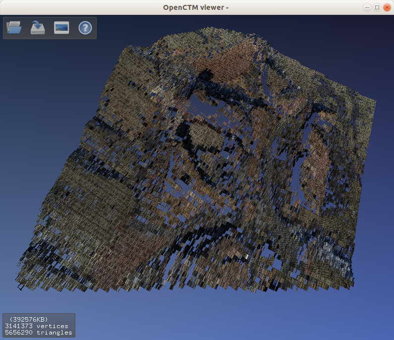
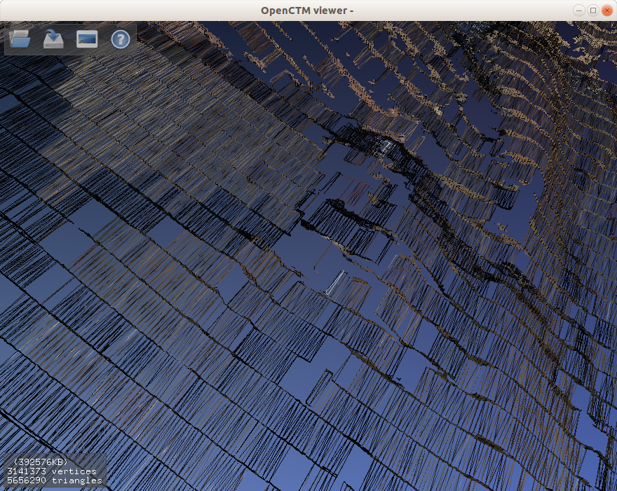
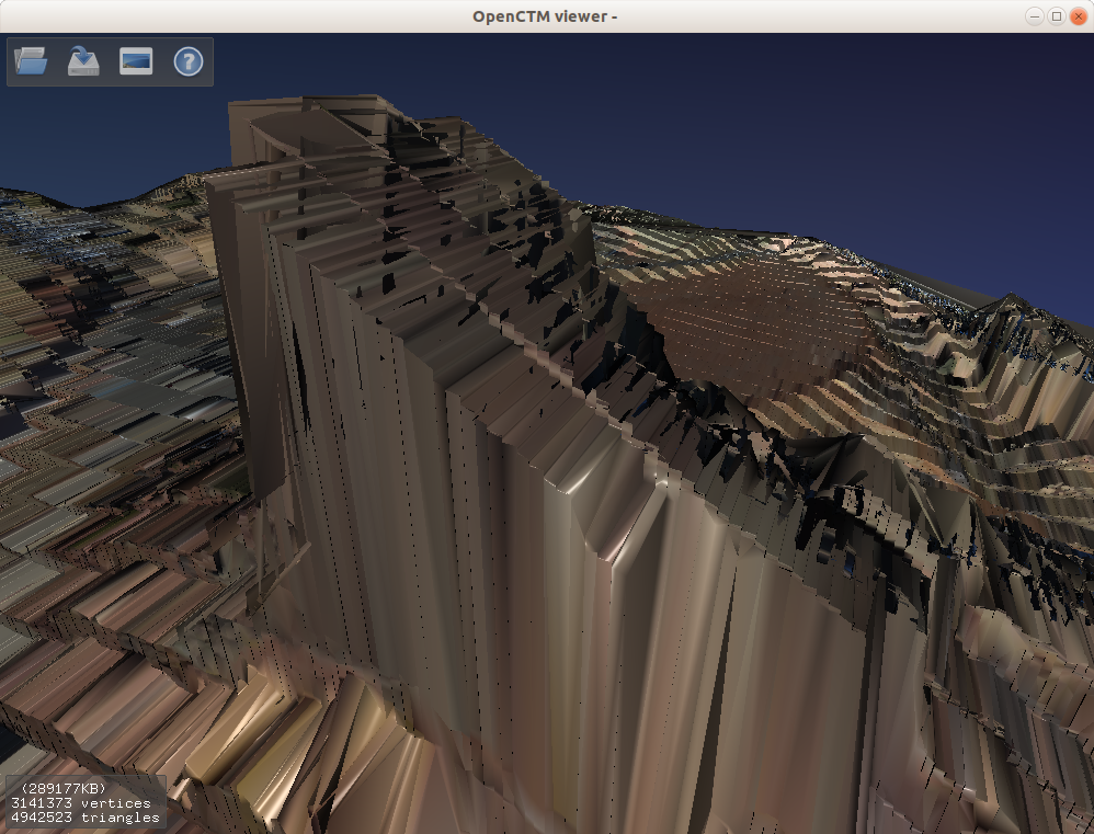
Poisson
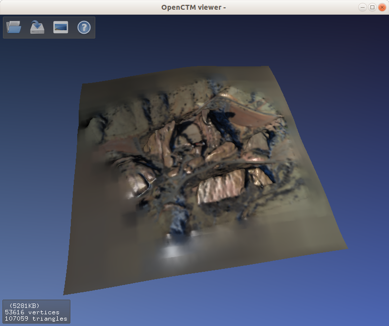
To go a little more “detailed”, I put depth to 12. The file went from 84M to 789M. And it is definitely overkill for 3D printing.
Grid Projection
Program failed to compute the grid projection.
 pdal pipeline dtm-gdal.json --verbose 8
(PDAL Debug) Debugging...
(pdal pipeline Debug) Attempting to load plugin '/usr/local/lib/libpdal_plugin_filter_gridprojection.so'.
(pdal pipeline Debug) Loaded plugin '/usr/local/lib/libpdal_plugin_filter_gridprojection.so'.
(pdal pipeline Debug) Initialized plugin '/usr/local/lib/libpdal_plugin_filter_gridprojection.so'.
(pdal pipeline readers.las Debug) GDAL debug: OGRSpatialReference::Validate: No root pointer.
(pdal pipeline readers.las Debug) GDAL debug: OGRSpatialReference::Validate: No root pointer.
(pdal pipeline readers.las Debug) GDAL debug: OGRSpatialReference::Validate: No root pointer.
(pdal pipeline Debug) Executing pipeline in standard mode.
(pdal pipeline filters.gridprojection Debug) 		Process GridProjectionFilter...
[pcl::GridProjection::getBoundingBox] Size of Bounding Box is [5.500000, 6.000000, 5.000000]
[pcl::GridProjection::getBoundingBox] Lower left point is [-2.500000, -2.500000, -2.500000]
[pcl::GridProjection::getBoundingBox] Upper left point is [3.000000, 3.500000, 2.500000]
[pcl::GridProjection::getBoundingBox] Padding size: 3
[pcl::GridProjection::getBoundingBox] Leaf size: 0.500000
(pdal pipeline filters.gridprojection Debug) 		3141373 before, 180 after
(pdal pipeline filters.gridprojection Debug) 		180
double free or corruption (!prev)
fish: “pdal pipeline dtm-gdal.json --v…” terminated by signal SIGABRT (Abort)
Cura 3D Print Slice
Cura can take STL inputs. Converting the PLY into STL is simple.
sudo apt install openctm-tools
Then ctmconv red-rocks-smrf-only-delaunay.ply red-rocks-smrf-only-delaunay.stl can convert ply to stl
ctmviewer red-rocks-smrf-only-delaunay.ply visualizes the ply. Which is what I used above.

Looks like the Poisson is prettier.
I’ll continue writing this latter, until I have something printed. 🙂
thank you for sharing. how to get that picture?
nice article. how do you use these 3D maps?
These maps are 3d point clouds, you can get some data from usgs public data source. I just convert them into EPT format and load it using the website; this particular picture is just Red Rocks Amphitheatre.