Notice: Function _load_textdomain_just_in_time was called incorrectly. Translation loading for the twentyfifteen domain was triggered too early. This is usually an indicator for some code in the plugin or theme running too early. Translations should be loaded at the init action or later. Please see Debugging in WordPress for more information. (This message was added in version 6.7.0.) in /var/www/sunapi386.ca/wordpress/wp-includes/functions.php on line 6121
Golden Gate – sunapi386's Blog

Golden Gate

I was playing around with the lidar dataset from UCSD and visualizing it on Entwine.


Wanted to share some beautiful cool pictures. Lidar is very interesting. Here are the links to play this yourself.

https://usgs.entwine.io/data/view.html?r=%22https://s3-us-west-2.amazonaws.com/usgs-lidar-public/ARRA-CA_GoldenGate_2010%22

https://s3-us-west-2.amazonaws.com/usgs-lidar-public/ARRA-CA_GoldenGate_2010/ept.json

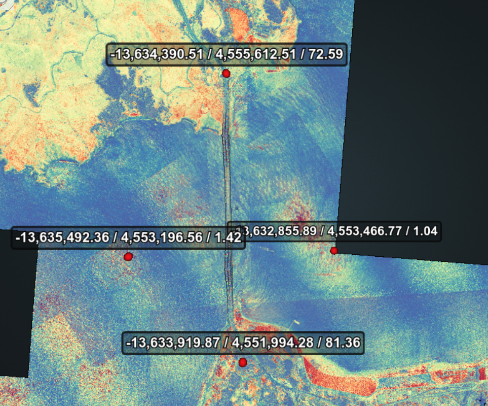
Looking at the data format, it the bounding boxes for the octo-tree here are:

Points

-13632855.894, 4553466.772, 1.042
-13635492.356, 4553196.558, 1.418
-13634390.511, 4555612.511, 72.595
-13633919.870, 4551994.285, 81.365

Ones in bold are the min/max vals, thus forming our X, Y bounds.

  {
      # type: readers.ept
      bounds: ([-13635492.356,-13632855.894], [4555612.511, 4551994.285])
      filename: https://s3-us-west-2.amazonaws.com/usgs-lidar-public/ARRA-CA_GoldenGate_2010/ept.json
      resolution: 0.5
      # up to 0.5m resolutions
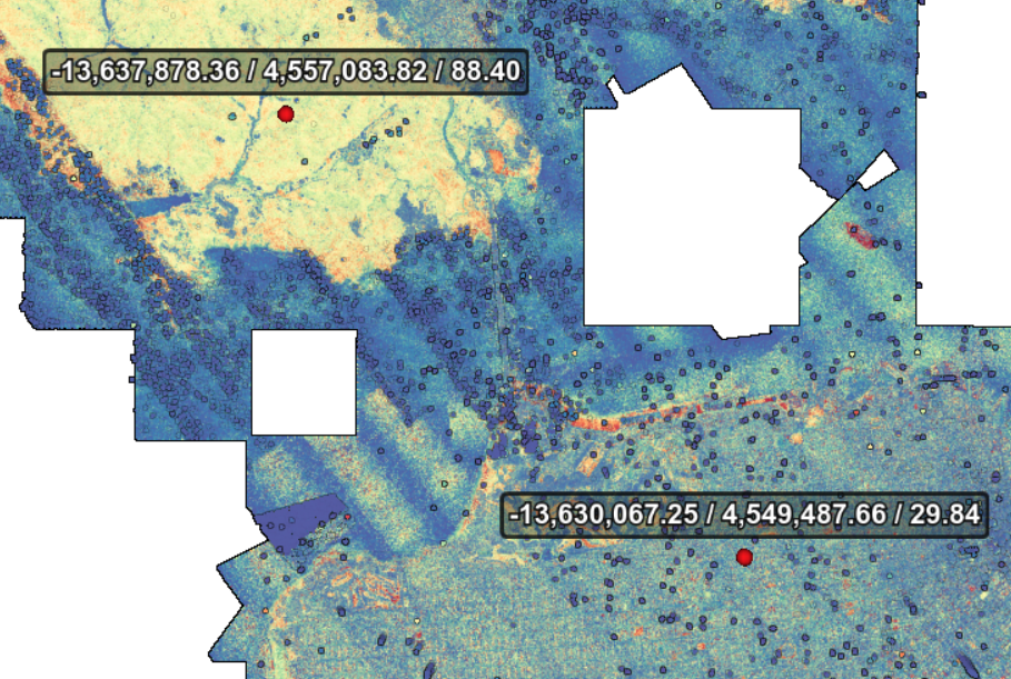
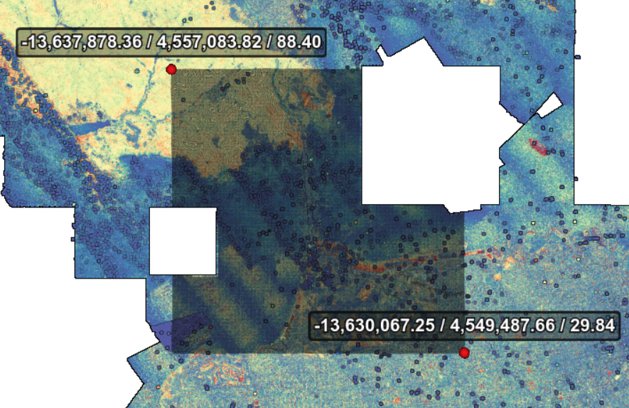
    }

Actually this didn’t return any data. So I’m doing another selection with larger area.

The pipeline

{
  "pipeline": [
    {
      "bounds": "([-13637879,-13630062], [4549481,4557084])",
      "filename": "https://s3-us-west-2.amazonaws.com/usgs-lidar-public/ARRA-CA_GoldenGate_2010/ept.json",
      "type": "readers.ept"
    },
    {
      "filename": "golden-gate.laz",
      "type": "writers.las"
    }
  ]
}

474M May 4 23:50 golden-gate.laz

I put together and loaded this data, visualized with potree:

http://potree.entwine.io/data/custom.html?t=%5B-13633083.085886605,4558454.642095785,-3140.1667813895765%5D&p=%5B-13633789.913150359,4538864.068838491,6564.589746511545%5D&r=%5B%22http://127.0.0.1:8080/golden-gate.laz/ept.json%22,%22https://s3-us-west-2.amazonaws.com/usgs-lidar-public/ARRA-CA_GoldenGate_2010%22%5D&m=8&era=%5B-148,781%5D&cf=%5B0,3,4,5,6,7,8,12%5D

Classification side view. Some noise can be seen.
Without noise
Without vegetation. The bridge seems to be (incorrectly) classified as such.
Without water.
Without unclassified, leaving just the ground.

That’s it folks!

Leave a Reply

Your email address will not be published. Required fields are marked *